Some voyage risks aren't visible on the chart alone. CIO+ delivers route-specific hazards, compliance overlays and real-time warnings directly to your ECDIS, giving bridge and shore teams a complete and unified risk picture.
Electronic Navigational Charts are the foundation of safe navigation, but they cannot show everything. Warnings, uncharted shoals, security threats and environmental boundaries change constantly and are scattered across multiple sources. Without a unified picture, bridge officers must manually collect and plot this data themselves, creating gaps that increase the risk of incidents, non-compliance and PSC findings.
CIO+ closes that gap. Working as a user chart loaded directly onto your ECDIS, CIO+ automatically delivers route-specific warnings, NoGo lines, StayAway areas, environmental limits and security alerts in a single, consistent overlay. Your officers always have the information they need, in the place they are already looking, whether on the bridge or managed from shore. CIO+ also represents a natural first step towards S-100, introducing crews and fleets to the layered, data-driven approach to non-charted information that will define the next generation of digital navigation.

Reduced Officer Workload: Automated overlays replace slow, error-prone manual charting of T&P notices, NAVAREA warnings and hazard data, freeing officers to focus on the voyage.
Fewer Audit Findings: With compliance boundaries, warnings and hazards plotted automatically and consistently, operators report stronger PSC and vetting outcomes and fewer audit findings.
Request InfoAutomatically plots T&P notices and Radio warnings on ECDIS, updated daily or on demand, providing voyage-wide navigational warning coverage across the entire intended route. CIO+ combines UKHO T&P notices, local hydrographic office notices and coastal warnings from more than 130 authorities, extending visibility beyond the limits of NAVTEX and VHF broadcasts.
Satellite-derived shallow water intelligence displayed directly in ECDIS for areas with CATZOC worse than A2. Using satellite imagery to identify uncharted shoals, rocks and reefs that may not appear in ENC data, StayAway helps support OCIMF, RightShip and PSC requirements. Delivered in real time through NavCloud and currently available across South-East Asia and the Caribbean Sea.
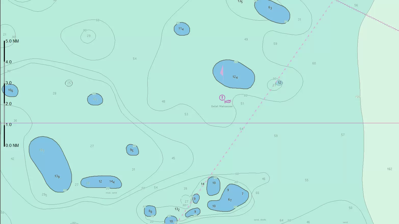
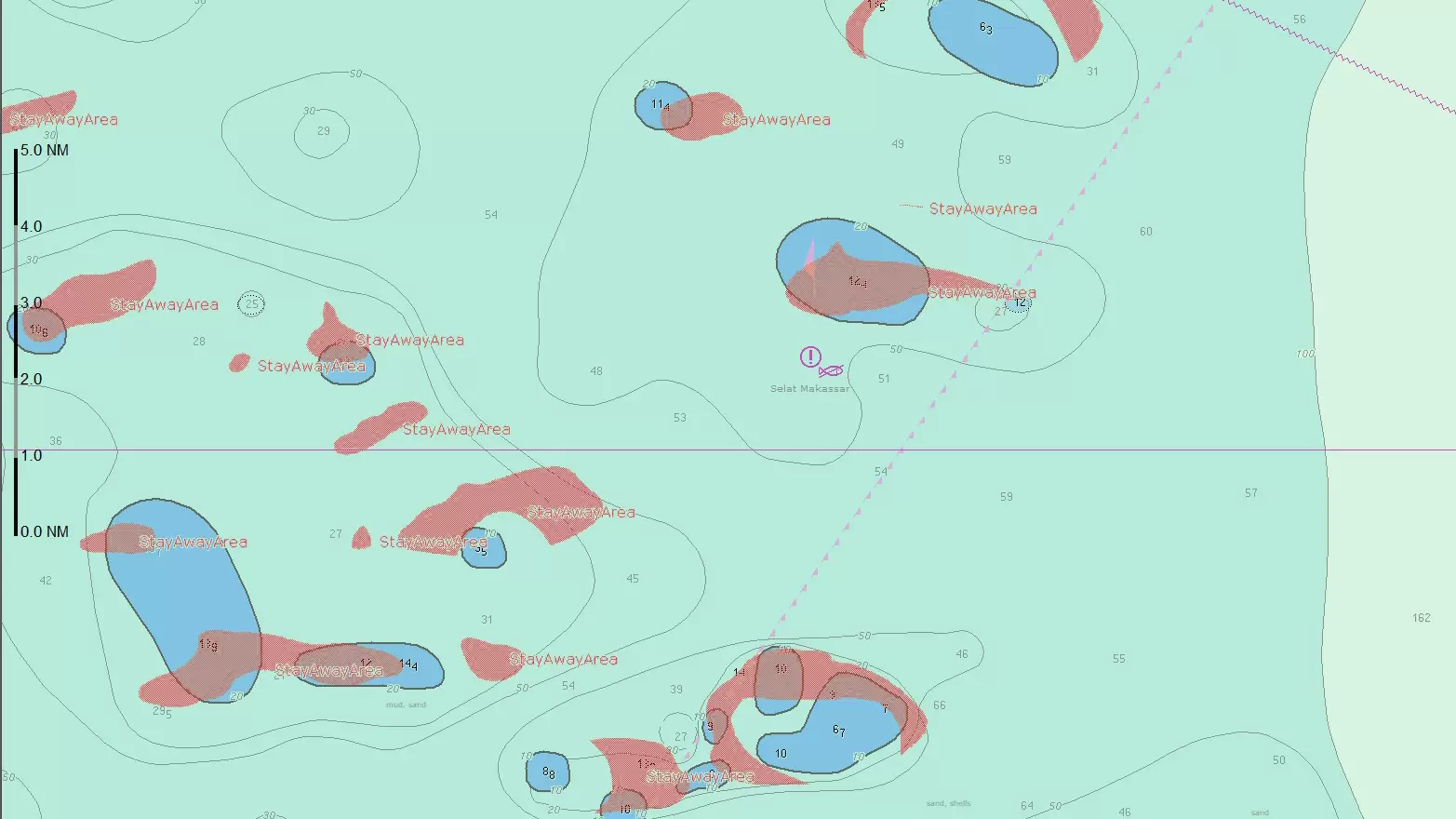
Vessel- and voyage-specific NoGo lines are generated from the defined safety contour, clearly identifying areas that should not be crossed to avoid navigational hazards. Automatic ECDIS alarms provide advance warning when approaching a NoGo boundary, with additional danger alerts beyond standard ECDIS requirements. Automatically detecting navigational hazards during voyage planning, NoGo helps reduce crew workload and minimise the risk of human error.
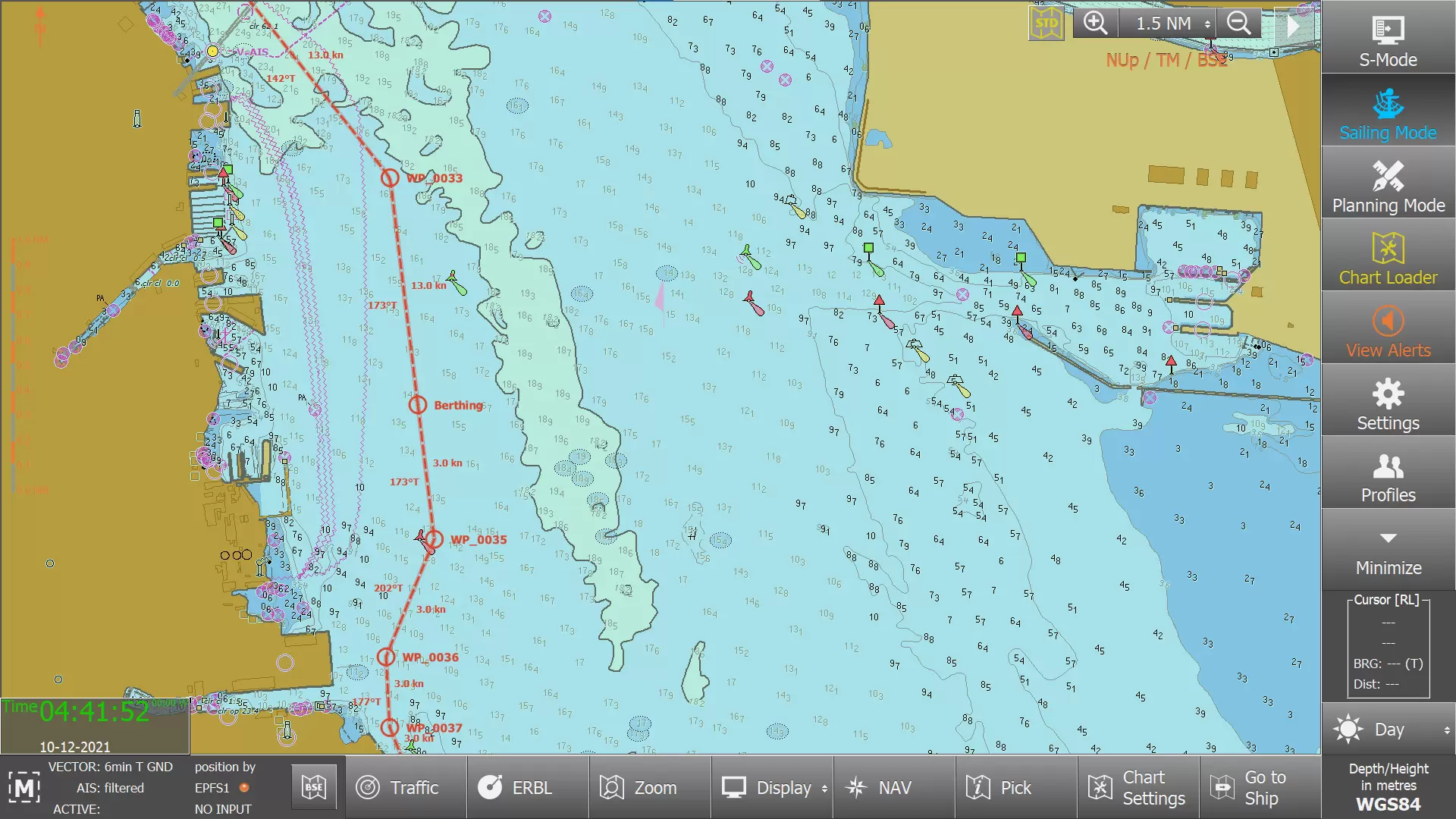
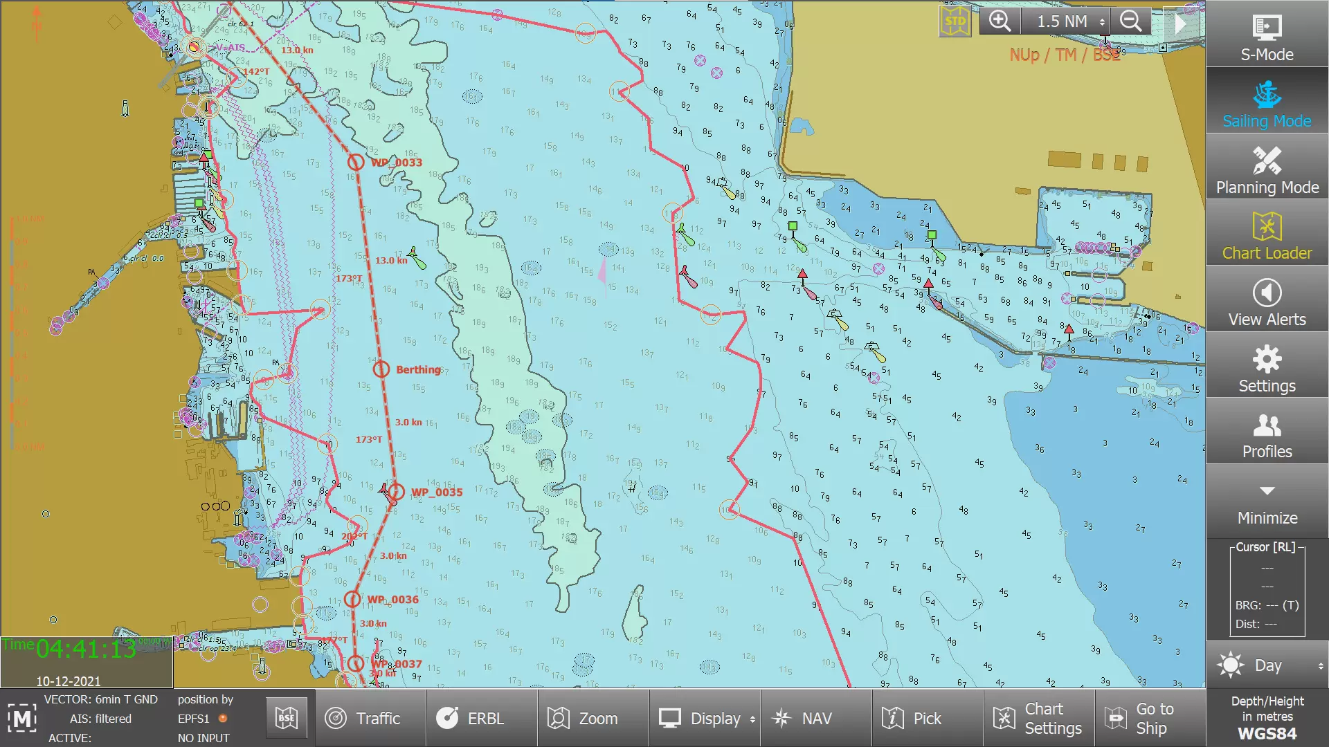
Highlights intersections with MARPOL Special Areas, Emission Control Areas and EU Sulphur Directive zones along your planned route, indicating where the route enters or exits these areas, with ECDIS alarms in both planning and monitoring modes.
Real-time, vessel-specific security alerts are displayed directly on ECDIS, helping crews to identify piracy threats, suspicious vessel activity and geopolitical stability along the planned route. Powered by Ambrey.

Find out how CIO+ can strengthen safety, reduce findings and give your fleet the complete risk awareness it needs on every voyage. As a first step towards S-100, it is also the smart way to prepare your operations for the future of digital navigation. Speak with an expert today.