MyFleet gives shore-side teams a unified, real-time view of voyage plans, vessel positions, and fleet safety data, accessible from anywhere in the world. Monitor, validate, and act with confidence, without setting foot on board.
Your vessels are always moving. Your shore-side team needs to move with them. MyFleet is a web-based fleet monitoring platform built for fleet managers, marine superintendents, and operations teams who need complete, real-time visibility of voyage execution without being on board.
From planned routes to active voyages, weather overlays to safety alerts, MyFleet consolidates everything your team needs to perform shore-side voyage due diligence into a single, intuitive platform. Whether you are managing a fleet of two vessels or twenty, MyFleet gives you the confidence to validate voyage plans, monitor compliance, and act on emerging risks, wherever you are in the world.

Stay Alert to Risk: Receive notifications for key vessel movements, voyage milestones and operational events, helping your team stay ahead of important developments as they happen.
Investigate with Confidence: The Incident Investigation Module provides access to daily recorded replay files from your eGlobe G2 or Pathfinder ECDIS, supporting post-voyage analysis, performance reviews, and incident investigations.
Request Info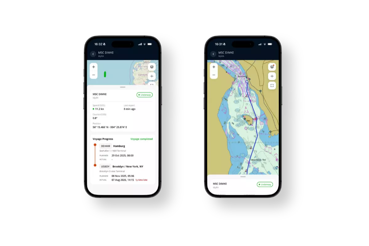
With the new MyFleet App
Take your fleet with you. Read how the new MyFleet App for iPhone and Android puts vessel positions, voyage progress, and ETAs in your pocket.
Discover the MyFleet AppWMS chart display with background options including TheChart, OpenStreetMaps, and Bing Maps, plus navigational, weather, and environmental overlays in a single view.
View and download planned, active, modified, and executed voyage plans in printable, RTZ, and T&P formats, with AIS-based vessel position monitoring.
Calculate optimised Voyage Orders for Laycan and Laden legs using configurable speed, RPM, engine load, and weather limit parameters with integrated CII Predictions.
CIO+ StayAway reveals hidden shoals and shallow hazards from satellite imagery, while Custom Areas lets you display company-specific zones and restrictions directly on the chart.
MyFleet supports SOLAS Chapter V voyage planning requirements and integrates with eGlobe G2 and Pathfinder ECDIS, type-approved to IMO MSC.232(82) and IEC 61174. ECA area overlays and CIO+ Environmental zone data support MARPOL compliance monitoring.

Talk to our team to find out how MyFleet can strengthen your voyage oversight and fleet operations.