ChartWorld and Raymarine Commercial unify to form single commercial navigation brand
Learn more
As maritime navigation becomes increasingly reliant on satellite-based systems like GPS and GNSS (Global Navigation Satellite System), the threat of signal interference, particularly jamming and spoofing, has become a serious concern for vessel operators. These disruptions can compromise navigational accuracy, endanger crew and cargo, and even lead to collisions or groundings if not properly managed.
Monday - 07 July 2025
GNSS jamming involves the intentional transmission of signals that block or degrade satellite navigation reception. Spoofing deceives a receiver by broadcasting false signals that mimic legitimate GNSS data, potentially leading a vessel to believe it is in a different location than it actually is.
These threats are no longer theoretical. Incidents have been reported in busy shipping lanes, near conflict zones, and even in commercial ports. The consequences can be severe and vessels may experience minor course deviations, complete loss of situational awareness, or even navigational errors that put lives and assets at risk.
Modern Electronic Chart Display and Information Systems (ECDIS) are equipped with tools that help bridge teams detect and respond to GNSS anomalies. While the specific interfaces may vary, systems from providers like Raymarine Commercial and ChartWorld offer robust features that support safe navigation even when satellite signals are compromised.
Common features include:
DR calculates the vessel’s estimated position based on heading and speed through water, without relying on GNSS. This method becomes essential when satellite signals are lost or unreliable. Alerts can be configured to notify operators when the DR position significantly deviates from the GNSS position.
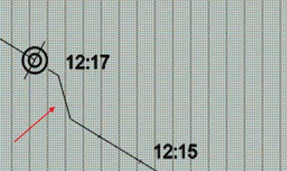
Using radar bearings and visual observations, navigators can manually plot positions on the chart. This method is especially useful when GNSS data is suspect. Most ECDIS platforms support integration of these fixes to validate or correct the vessel’s estimated position.
When connected to radar systems, ECDIS can use ARPA (Automatic Radar Plotting Aid) targets to establish position references. By tracking fixed objects, the system can generate reliable fixes even in the absence of GNSS.
Some systems allow the use of radar-acquired targets as reference points for positioning. This method enhances accuracy and provides a valuable backup when GNSS is unavailable or compromised.
GNSS jamming and spoofing are real and growing threats to maritime safety. With the right tools and training, vessels can navigate safely even in compromised environments. Modern ECDIS systems from providers like Raymarine Commercial and ChartWorld are designed to support resilient navigation.
In particular, Raymarine Commercial’s Pathfinder ECS and ECDIS platforms offer enhanced situational awareness through features such as:
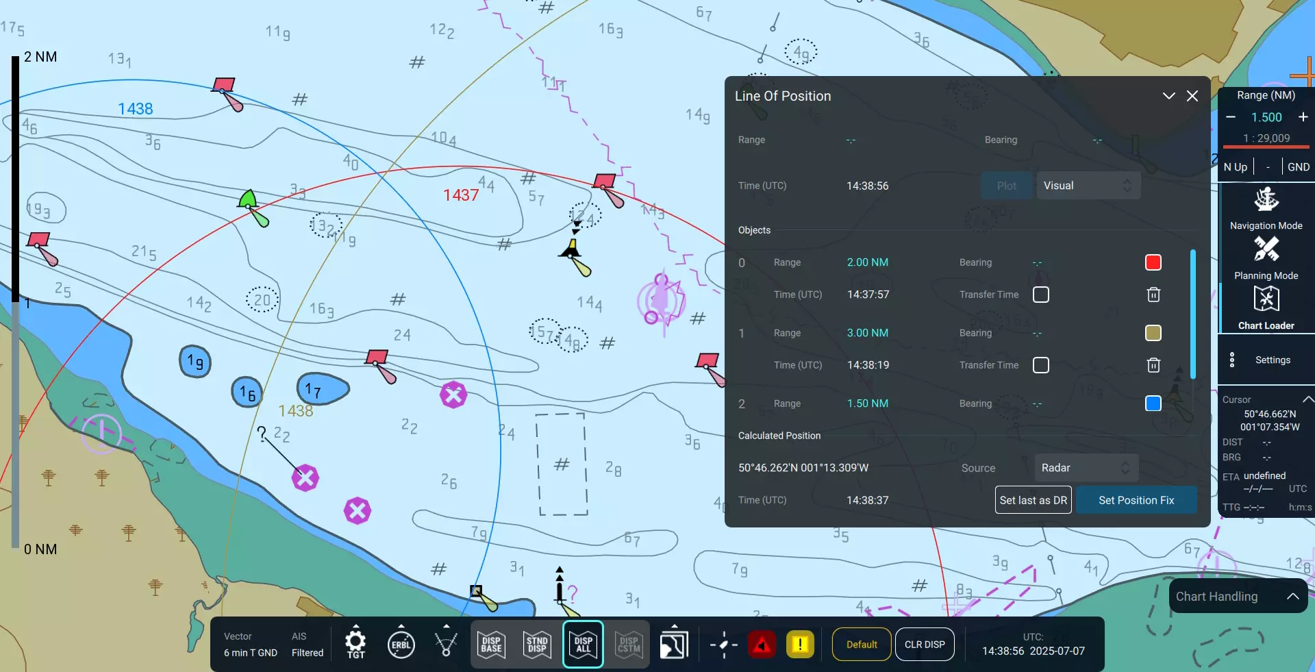
Easy entry of Lines of Position (LOPs)
Position Delta Monitoring
These capabilities help bridge teams detect and respond to GNSS anomalies quickly and effectively. By combining advanced technology with best practices, mariners can maintain control and confidence when it matters most.